lisdem
Dissolved city
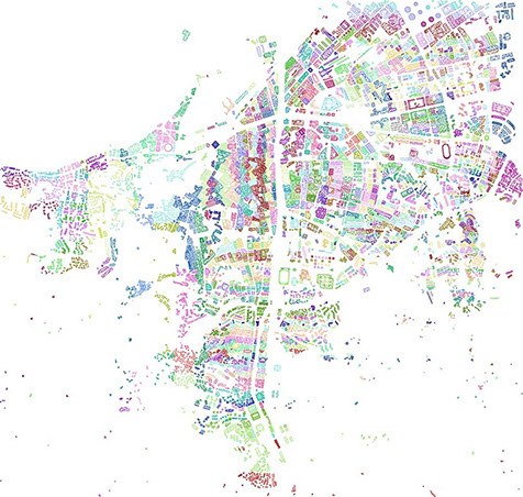
Mapping the city
2010
Video: Cities in Space and Time Ørestad, Copenhagen
2014
The concept of the "Dissolved City" introduces an innovative approach to urban mapping that reimagines the function and significance of buildings within the urban environment. By employing a color-coding system, this map dissolves traditional programmatic functions, fostering a new perspective on the potential uses and relationships of fixed building typologies. This paradigm shift emphasizes the reusability of buildings and their components, transcending conventional boundaries from industrial to residential, infrastructure to rural, and private to public domains.
The Dissolved City map challenges the rigid, single-purpose use of urban structures, advocating for a dynamic, adaptable urban landscape that embraces multifunctionality and sustainable reuse. This reconceptualization opens a vital dialogue on the future of urban development, encouraging a more flexible and resilient approach to the built environment.
<

>
Projects
Research
Publications